The Emerging Threat
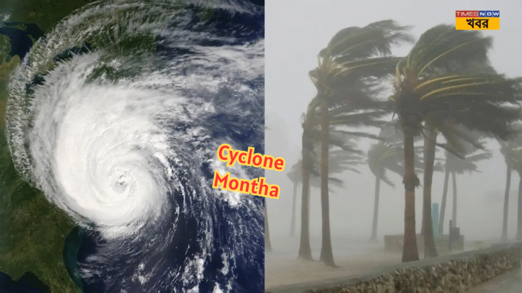
The tropical system named Cyclone Montha is currently developing over the Bay of Bengal and is being monitored closely by the India Meteorological Department (IMD). According to official bulletins, Montha has already intensified into a cyclonic storm, with sustained winds of about 90-100 km/h and gusts reaching up to 110 km/h.
Although its initial landfall trajectory is projected along the east coast near Andhra Pradesh and Odisha, the meteorological agencies have warned that its influence will extend far inland and also cover parts of West Bengal.

In particular, the IMD’s Regional Meteorological Centre in Kolkata has issued forecasts showing heavy rainfall and associated hazards for the coastal and southern districts of Bengal.
This article explores in detail what South Bengal can expect from Cyclone Montha, which districts are most at risk, what the IMD warning levels are, how residents can prepare, and what the likely impacts may be in terms of rain, wind, flooding and disruption.
Which South Bengal Districts Are Under Watch
The IMD has issued alert levels and specific district-lists for South Bengal where heavy to very heavy rainfall is anticipated as part of Cyclone Montha’s peripheral effects. According to the forecast:
- The coastal and southern districts of South 24 Parganas, East Midnapore (Purba Medinipur) and West Midnapore (Paschim Medinipur) are expected to experience heavy rainfall and thunderstorms.
- The districts of Howrah and North 24 Parganas as well as Jhargram have been named in the alert list for South Bengal’s weather impact
- A yellow alert was also issued for some North Bengal districts (such as Malda, North & South Dinajpur, Jalpaiguri) because of rain-influx, but the heavier impact is likely to remain in South Bengal.
Specifically, the rain forecast for South Bengal: the IMD says “heavy rain (7-11 cm) very likely at one or two places over South 24 Parganas, Jhargram and East & West Medinipur districts” for 29 October.
Thus, residents, local authorities and relief agencies in these districts must remain alert for the next 1-3 days, especially along low-lying coastal zones and areas prone to flooding or waterlogging.
Alert Levels & What They Mean
The IMD uses a colour-coded alert system in its district-wise advisories:
- Yellow Alert: Be aware; some bad weather expected.
- Orange Alert: Be prepared; bad weather likely with some potential for danger.
- Red Alert: Take action; very bad weather expected with high danger to life and property.
For South Bengal, the IMD has issued a yellow alert for 28 and 29 October for many of the districts mentioned.
However, some media reports suggest the possibility of orange alert too, due to “heavy to very heavy rain, squalls, water-logging” etc
Understanding these alert levels is important: It means that although the cyclone centre may not hit West Bengal directly, the outer bands, increased moisture flow, and dynamic weather changes can lead to significant rain, wind and flood hazards nonetheless.
What to Expect: Rain, Wind & Secondary Hazards
Rainfall
Because Cyclone Montha is large and pulling moisture from the Bay of Bengal, the affected South Bengal districts can expect:
- Heavy rainfall: the IMD forecasts around 7-11 cm in a 24-hour period at some places in South 24 Parganas, Jhargram, East & West Medinipur
- Very heavy rainfall / isolated extreme downpours: Some localities might cross higher thresholds (i.e., over 11 cm) if the bands linger.
- Waterlogging and flooding: in low-lying areas, drainage poor zones, coastal fringes and river/creek banks — the IMD specifically warns of water-logging and landslides in vulnerable tracts.
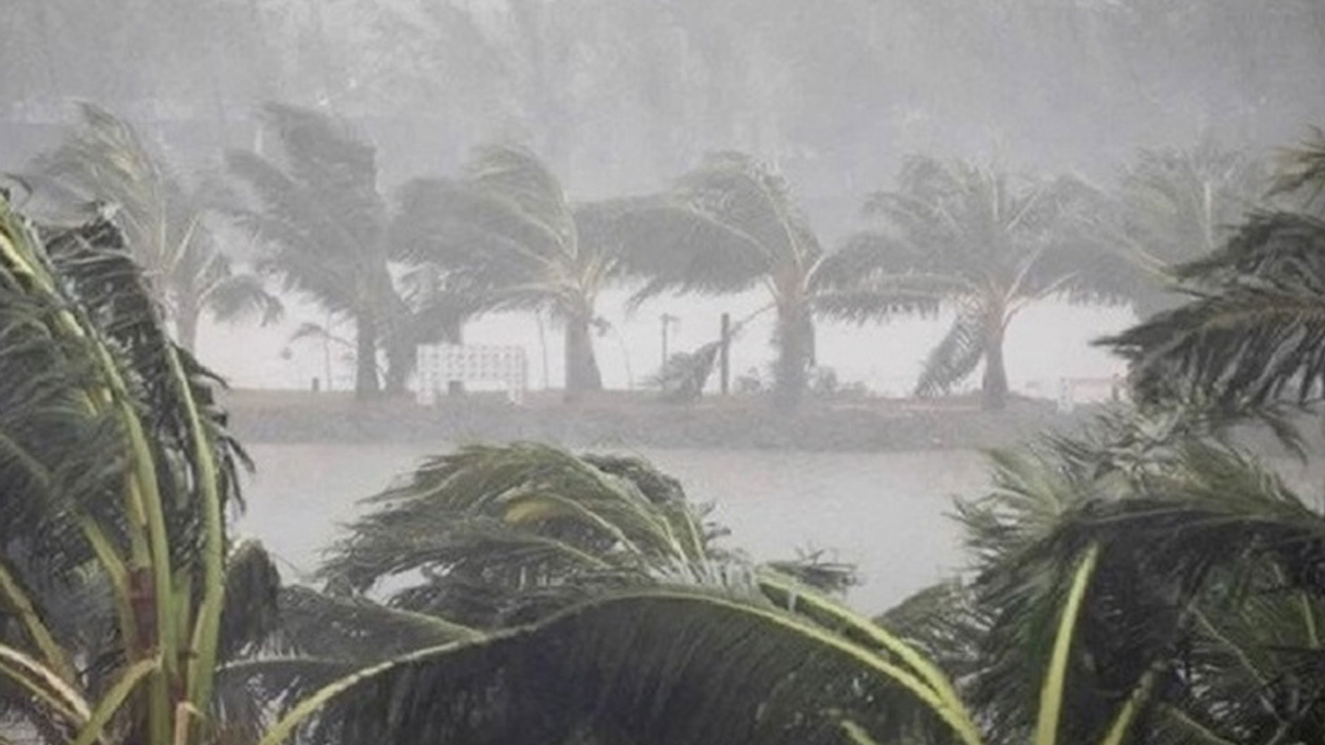
Wind & Squalls
- While the cyclone’s core wind field may not directly slash into West Bengal, the peripheral winds can still generate gusts of 35-45 km/h, possibly higher in coastal zones (55 km/h+) and near squalls.
- Squall lines (strong, sudden wind bursts often associated with thunderstorms) may accompany the rain bands, leading to uprooted trees, power outages, debris flying.
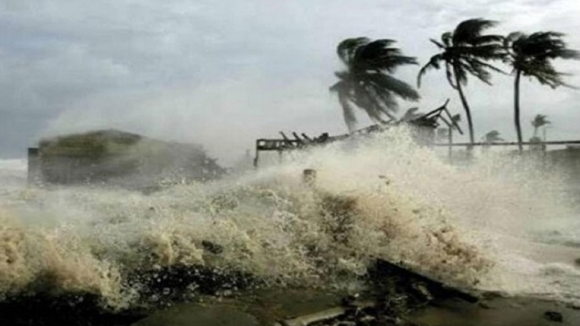
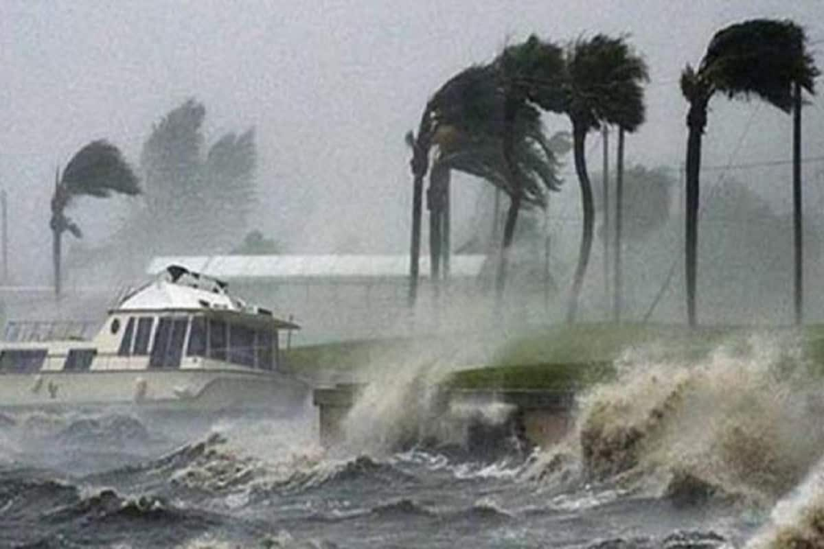
Coastal & Surge Effects
- The coastal districts (South 24 Parganas, East/West Midnapore) may face rough seas, high waves, and storm surges especially in the Sundarbans fringe and deltaic channels. While the main landfall is elsewhere, the ripple effect can reach the Bengal coast.
- Fishermen and coastal boat-owners are advised not to venture into the sea until further notice. The IMD and local fisheries departments will issue such advisories.
Secondary Hazards: Landslides, Flooding, Infrastructure Risk
- Hilly or undulating tracts (though fewer in South Bengal than North) can experience landslips especially where soil is saturated daily. The IMD has cited this risk.
- Roads, railway tracks, embankments and rural communication lines may get disrupted due to fallen trees, water-logging or wash-outs.
- Crop damage is possible particularly for standing paddy, vegetables, horticulture in the open fields of coastal South Bengal.
- Urban-areas like Kolkata may face waterlogging, traffic disruptions, and power cuts if rain + wind combine.
Why South Bengal Is Also In The Line, Even If Landfall Is Elsewhere
Though Cyclone Montha’s landfall is expected further south (Andhra/Odisha), the weather system’s breadth and movement mean that its outer bands, inflow of moisture, and induced low-pressure zones can reach into neighbouring states, including West Bengal. Key reasons:
- The cyclone draws moisture-laden winds northwards across the Bay of Bengal, which then bleed into the adjacent coast of Bengal.
- The low-pressure area associated with the cyclone creates instability in the atmosphere over Bengal, increasing rain chances.
- The inter-state propagation of such systems means even if the eye doesn’t cross Bengal, rainfall, gusts and waves can impact the state indirectly.
- The IMD forecast specifically mentions “heavy rainfall across coastal South Bengal … thunderstorm with lightning … wind gusts possible” for the next days.
Hence, local authorities and residents in South Bengal must stay vigilant even though the landfall locus is further south.
Preparedness & What Residents Should Do
Given the forecast and alert levels, here are key actions for residents, local bodies and disaster management authorities in South Bengal districts:
For Residents
- Stay updated: Follow official bulletins from IMD and state disaster-management authorities.
- Avoid risky areas: Stay away from riverbanks, creek edges, embankments, flooded roads, and coastal sands.
- Secure property & loose items: In homes, secure potted plants, movable objects, loose sign-boards, thatch structures.
- Have emergency kit ready: Torch, batteries, first-aid kit, essential medicines, drinking water and dry rations.
- Power & water backup: Be prepared for possible power outages and water-supply disruptions.
- Children & elders: Keep extra care for vulnerable groups (children, older persons, pregnant women) in heavy-rain periods.
- Avoid travel during heavy rain: Roads may be flooded, visibility low, risk of water-logging high.
For Local Authorities & Administration
- Activate control rooms and ensure 24×7 monitoring in the affected districts.
- Pre-position relief shelters and camps especially in low-lying and coastal zones of South 24 Parganas, Medinipore districts.
- Coordinate with power, water, health departments to respond to outages or emergencies.
- Clear drainage channels in urban areas and maintain embankments in rural zones.
- Issue safety advisories to fishermen, coastal dwellers, schools (possible closure) and transport heads.
- Monitor weather pulse every few hours via IMD bulletins and update the public accordingly.
Impact Potential: What Could Happen If Precautions Are Not Taken
- Severe water-logging and flooding in low-lying districts such as South 24 Parganas or coastal villages in East/West Medinipur, causing displacement and property damage.
- Crop losses, especially for winter-paddy, horticulture, open-field vegetable cultivation in coastal tracts.
- Infrastructure damage: Roads, rail lines may be blocked by tree falls, landslides; power cuts may extend for hours.
- Risk to life: Onset of imagined safety may lead to complacency; stranded persons in flooded zones, or those in weak structures may face high risk.
- Disruption of transport, commerce: Movement of goods, fishing operations, small industries may be hit; port operations along Bengal coast may suspend.
- Health hazards: Stagnant rainwater can become breeding grounds for mosquitoes; also, slippery roads and landslips pose immediate physical hazards.
Timeline & What’s Next
- By 28-29 October: South Bengal likely to witness its main rainfall and gusty-wind phase, as per IMD.
- Through 30 October: The rainfall effects may carry over; additional districts may be brought under alert.
- After 30 October: As the cyclone weakens inland, the risk for South Bengal will gradually reduce; however, residual moisture could still generate heavy showers.
- Post‐event: Relief, damage assessment, restoring power & transport will be critical in the days after the peak weather.
Closing Thoughts: Stay Alert, Act Early
While South Bengal is not bearing the direct brunt of Cyclone Montha’s landfall, the indirect effects — heavy rain, gusty winds, flooding and disruption — are very real and should not be underestimated. The IMD’s forecast is clear: negative weather impacts in South 24 Parganas, East & West Medinipur, Howrah, North 24 Parganas and Jhargram are expected. Prompt response from residents, local authorities and disaster management agencies can reduce risks significantly.

As we have seen in past storms, the peripheral zones of a cyclone often pay a steep price through flooding, infrastructure damage and agricultural losses. Being forewarned means being fore-prepared — so it’s time for all concerned in South Bengal to review safety plans, heed the official alerts and not delay in taking protective action.